
Thank you for reading our post, please rate this article at the end.
Reading Time: 12 minutesLast Updated on December 27, 2025 by Paul Clayton
Table of Contents
How Long Does It Take to Hike the Appalachian Trail?
Key Takeaways
-
-
Distance and Scope: The AT is a 2,190-mile trail spanning 14 U.S. states, running from Springer Mountain in Georgia to Mount Katahdin in Maine.
- Time Commitment: Most “thru-hikers” complete the journey in four to seven months, typically traveling from March to December to avoid harsh winter conditions.
- Hiking Directions:
- Northbound (NOBO): The most popular route (starting in GA). It offers a social experience but is prone to overcrowding and environmental strain.
- Southbound (SOBO): A quieter but more difficult route (starting in ME) that begins with the trail’s most rugged terrain; recommended for experienced hikers.
- Flip-Flop: An alternative strategy where hikers start in the middle (e.g., West Virginia) to enjoy easier terrain and avoid peak crowds and weather extremes.
- Accommodation: Hikers can use more than 250 three-sided shelters (lean-tos), spaced about five miles apart, on a first-come, first-served basis, or stay at designated campsites.
- Navigation & Logistics: While traditional maps are available, modern guidebooks are essential for detailed topography. Hikers must also be prepared for river crossings, particularly in Maine, where ferry services or ropes may be required.
- Conservation and Rules: The trail is managed by the National Park Service and the Appalachian Trail Conservancy. Hikers are expected to follow specific regulations regarding “dispersed camping” and fire use to protect the wilderness ecosystem.
-
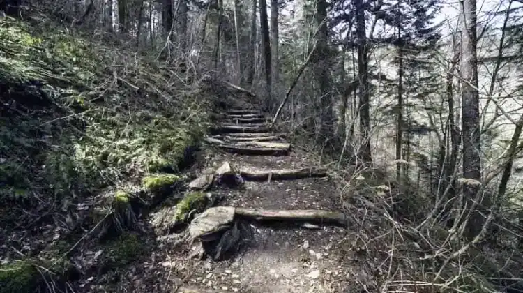
The Appalachian Trail is one of the world’s best-known long-distance hiking routes. The experience gained from it is phenomenal. Epic would be an understatement. This is likely why three million people complete the hiking challenge on this trail every year.
Let not this number fool you; only a fraction of them manage to trek the entire trail. This tells you that persistence and determination are part of the job description.
Frequently Asked Questions
Q: How long does it actually take to hike the entire Appalachian Trail? Most thru-hikers complete the trail in four to seven months. Your specific duration will depend on your physical pace, weather conditions, and the number of seasons you experience during your trek.
Q: What is the difference between a “NOBO” and a “SOBO” hike?
-
NOBO (Northbound): Starts at Springer Mountain, Georgia, and ends at Mount Katahdin, Maine. it is the most popular route and very social.
-
SOBO (Southbound): Starts at Mount Katahdin and ends at Springer Mountain. This is more challenging because it begins with rugged terrain and is recommended for experienced hikers.
Q: Where do hikers sleep while on the trail? Hikers have two primary options: staying in one of the 250+ permanent wooden shelters (lean-tos) located about every five miles, or using a tent at designated campsites. Some areas allow “dispersed camping” (setting up your own site), though this is strictly regulated in certain parks to protect the environment.
Q: When is the best time of year to start the hike? Most hikers position their journey between March and December to take advantage of spring, summer, and autumn. Starting too early or staying too late can create hazardous winter conditions, including deep snow and storms. Specifically, Mount Katahdin in Maine generally requires hikers to finish by October 15th due to seasonal closures.
Q: How do hikers cross rivers and streams along the route? While most water crossings are manageable, some require “fording” (wading through the water), especially in Maine. In areas with high water levels, guide ropes may be provided. For the Kennebec River, which is over 200 feet wide and dangerous due to upstream dams, a dedicated ferry service is provided for hiker safety.
The Appalachian Trail, popularly known as the AT, is 2,190 miles long and passes through 14 states. It extends between Mount Katahdin in Maine and Springer Mountain in Georgia. However, there is also an extension called the International Appalachian Trail, which extends north into Canada and ends in Newfoundland.
These 14 states include North Carolina, Georgia, Tennessee, West Virginia, Virginia, Maryland, Pennsylvania, New York, New Jersey, Maine, Vermont, Connecticut, New Hampshire, and Massachusetts.
This trail is long, and so is its maintenance. More than 30 clubs have contributed to its construction and repair. They are all managed by the National Park Service in partnership with the Appalachian Trail Conservancy. Most of the trail runs through wilderness, though some sections pass through crossroads and towns.
As juxtaposed as it is, you will interact with life in the cities and  wilderness.
How long does it take to hike the Appalachian Trail? This is what this article is all about. We delve deep into more than that, telling you everything you need to know about this epic trail, from the culture around it, hiking strategies, the routes to follow, and the best time to hike it, to the preparations to undertake.
We aim to provide you with a detailed, plain-language guide you can understand. Everything is yours for the taking. We’re confident that by the end of this guide, you will want to take yourself through the experience.
This is a little spoiler. So, prepare yourself emotionally.
How Long Does It Take to Hike the Appalachian Trail
We don’t want to keep you waiting, so we’ll get straight to answering your question. Most thru-hikers spend between four and seven months hiking through the Appalachian Trail. Please note the word ‘Most.’ It depends on your speed.
Some take less time than this, while others have a longer duration. The fourth and seventh months are where a larger bracket lies. This accounts for the typical pace for most hikers.
This duration means you will experience two or three seasons during your adventure. The best seasons for outdoor work are spring, summer, and autumn. Therefore, most hikers position their journey between March and December.
This doesn’t mean it is impossible to hike during the winter. However, the conditions at the time made it more difficult. There are generally deep snows, low temperatures, and unpredictable storms, which make hiking very hard.
The route used is another factor determining the best time of year to hike. The start and end points, along with the hike’s direction, will also help.
Most of the trail is open year-round for hiking, except in Baxter State Park and around Mount Katahdin. These are typically closed overnight on October 15th and open only during the day. Vehicles are usually denied access to the park on November 1st because winter is approaching, and it is too dangerous to summit the mountains.
Due to these regulations, management recommends that hiking on Katahdin be completed by the 15th of October for safety. This date isn’t set and may be moved earlier, depending on the circumstances.
Routes for Thru-Hiking
The route to hike through is one of the essential decisions that thru-hikers must make. The route will determine many things, including the time of the year for the hike. The route used will also affect the hiker mentally, physically, and socially.
2,190 miles is no joke, and you have to consider the route you will use. Luckily enough, there are a number of them. Consider our list of the available routes and the considerations to weigh.
Northbound
The Northbound hike, popularly called ‘NOBO,’ is one of the most popular choices many hikers settle for. This route extends from Springer Mountain to the summit of Mount Katahdin. Its popularity makes it very crowded.
In 2014, for example, 2,500 thru-hikers registered on the route, roughly 87% of the total number of hikers. This number is also 10 times that of those who chose the Southbound route.
The vast number is excellent for the social experience, but comes with costs. The large influx is a challenge, making it difficult to access some services and damaging the trail and its surroundings. Accordingly, management recommends that hikers choose alternative routes, if possible, for conservation reasons.
Northbound hikers typically begin their hike in late March or early April. This means that their hike will end around Late August or early October. The most popular starting dates are on 1st March, 15th March, and 1st April.
Expect large crowds on these dates, and consider alternative dates to avoid them.
What to Know
- Starting the hike at Springer Mountain is more physically, logistically, and mentally comfortable than starting at Mount Katahdin.
- Mount Katahdin is one of the most challenging mountains to climb, but also one of the most beautiful and scenic.
- With the enormous crowds, be sure to have the shelters overcrowded at the first few hundred miles.
- Large crowds increase the risk of exposure to and spread of communicable diseases.
- You should be prepared for winter during the first few months of your hike. Some parts will still experience deep snow and low temperatures until late April. Therefore, you need to carry heavy clothing and winter gear.
- The Mid-Atlantic states typically experience hot, humid conditions when mosquitoes are at their peak.
Southbound
Southbound hiking is the opposite of Northbound hiking. It is popularly known  as ‘SOBO.’ This route extends from the summit of Mount Katahdin southward to Springer Mountain.
The Southbound route is less popular than the NOBO route. A significant reason is that this route requires hikers to start with the most challenging terrain. Hikers will begin with the rugged terrains and then move on to more than 100 miles of wilderness.
This route comes with all the White Mountains and South Maine challenges. These challenges make it difficult for novices to follow the SOBO. SOBO is well-suited to experienced and expert hikers.
Some hikers also prefer to finish their hike on Springer Mountain rather than Mount Katahdin, but this is strictly personal preference.
This route isn’t entirely as bad as it seems. Some love it, claiming that the first parts of the journey are supposed to be difficult. There is a good side to it. Southbound hikers typically begin their hiking in late June or early July.
This means that their hike will end around November or December.
What to Know
- Finishing your hike on Springer Mountain will be less scenic and epic than Mount Katahdin.
- You will come across fall colors in the Southern Appalachians and Virginia.
- A few hikers opt for the SOBO each year. This means that you will have fewer encounters with other hikers. The good side is that shelters, huts, and campsites will be less crowded.
- You may experience hot, humid conditions in parts of the Mid-Atlantic.
- In the summer months, expect heavy rainfall in New England. Prepare yourself for high streams and muddy trails.
- Black flies will be present, especially in June and July, and they are a nuisance.
- October is the hunting period for residents of the Southern States.
- You will begin to experience snow and cold weather as November approaches.
Other Routes
NOBO is associated with huge crowds and congestion. SOBO, on the other hand, has a challenging beginning that is unsuitable for newbies. Given these unfavorable conditions, many hikers have been seeking an alternative route that better meets their needs.
Alternative itineraries, ‘LeapFrog,’ ‘Head Start,’ and ‘Flip Flop,’ have been established for a more exciting adventure.
These alternative routes are becoming more popular because they appeal to many hikers. They are more flexible, and their starting and ending dates are also favorable. There are many methods of constructing the flip-flop hike.
A typical example is hikers who start near AT Point in Harpers Ferry in May. They hike to Mount Katahdin and arrive in August or September. They then return to Harpers Ferry, continue walking south, and finalize their journey at Springer Mountain around November or December.
What to Know
- This route allows hikers to start on the easiest terrain. It is in parts of Maryland and Pennsylvania.
- There are no congestion or crowd-related problems.
- You will be able to arrive in the Mid-Atlantic States before the summer temperatures begin.
- The temperatures in the White Mountains are pleasant in July.
- During the first half of your journey, you will encounter the early northbound hikers, and then you will discover the southbound hikers at the end.
- You can avoid mosquitoes in the Mid-Atlantic and black flies in Maine.
- You will catch the fly colors in Virginia and South of the Appalachians
- You might begin to experience the cold seasons in the Southern Appalachians as November nears.
Maps and Guidebooks
Traditional maps are provided on the trail, but they aren’t  as detailed as modern guidebooks. Despite this, they will provide all the valuable information required to hike the trail. The maps provide hikers with an overview of the surroundings and what to expect as they begin their journey.
They are unique in ways that differ from the guidebooks.
These maps will provide a solid foundation for understanding what to expect in terms of topography and offer insight into roads, forests, and relevant trails. The AT is huge, and there’s no doubt about that. Therefore, having all the information inside the maps will be impossible.
Guidebooks are also too small for the AT.
If hikers want a map of the entire trail, they can also purchase maps for specific sections. These affordable maps provide all the information you need for each section.
The choice of settling for either guidebooks or maps lies entirely with you. Guidebooks are cheap but heavy. They provide detailed and meaningful information about the mountains and other sections.
Maps are lighter but more expensive than the guidebooks. They will provide you with a view of the trail that the guidebook cannot. Going for both is an option if you are unsure which to choose. This, however, depends on your budget.
Camping and Shelters
Sleeping out in the woods isn’t a foreign sight for hikers. This is a regular part of life for thru-hikers. When night falls near the AT, you have two options for settling for the night.
You can use existing AT shelters or create your own traditional setup.
Shelters
AT has established shelters known as lean-tos or huts, which are unique to hiking trails. These shelters are generally three-sided wooden structures with an elevated wooden floor and an overhanging roof.
These shelters were built to minimize and manage the dispersed  settlements along the trail, especially at night. The AT has more than 250 of these shelters, strategically located near river banks and other reliable water sources.
The distance between these shelters varies. They are, however, not far from each other, typically at a walking distance of about five miles. The shelters are constructed and maintained by the local trail clubs.
These huts vary in size, holding between five and twenty hikers. They are open to every hiker and operate on a ‘first come, first serve’ basis. Please note that all travelers, not just thru-hikers, may camp in these shelters.
If you arrive late and find that the shelters are already full, you will have no option other than to set up a temporary shelter for the night. We therefore can’t emphasize enough how important it is to arrive early if you’re looking to catch up on one of these huts.
Essential amenities are provided within the shelters, which vary by location. Some include a picnic table, bear-bagging systems, and fire pits.
Most, but not all, huts are equipped with extra space for tents if the hut is complete for the night. These are the key benefits of the shelters. The other side of the coin is the downsides to consider.
Before deciding to settle for shelters, here are some of the things that you need to consider.
Camping
If you arrive late and find the shelters full, you can also set up traditional camping. The good news is that more than 100 campsites are available along the Appalachian Trail. Similar to the shelters, the camps are located near water sources.
The only difference is that they lack some amenities available in the shelters.
Some well-equipped campsites have wooden tents. Please note that you’ll need to pay a small fee for some campsites. In addition to the established campsites, there are other areas along the AT where hikers may set up their own camps, a practice known as ‘dispersed camping.’
The dispersed campsites are marked in the maps and guidebooks so hikers can locate them easily.
Amid all this, some rules and regulations apply to dispersed camping. Different parks, towns, and states have rules you must adhere to. Some of these rules include the following:
- Dispersed camping is strongly forbidden in the Great Smoky Mountain National Park.
- Hikers must remain only at the designated campsites and shelters.
- Some places prohibit the use of campfires outside the campsites.
These are just a few of the many rules set. The rules ensure peaceful coexistence among hikers and non-interference with the ecosystem and surroundings. It is, therefore, your responsibility as a hiker to be aware of the set rules and regulations of different places.
Also, ensure that you stick to the rules to avoid conflicts.
One problem with dispersed camping is that it interferes with the trail and its surroundings. For this reason, it is generally advised to avoid establishing new campsites and to use existing campsites. This will help preserve the trail’s ecosystem and surroundings.
This enables the trail to endure over time and allows those who come after you to enjoy it as you did. We all wish for that to happen, don’t we?
Fording Water Bodies
Once in a while, you will be required to ford rivers, creeks, and streams,  although on rare occasions. This is especially common in Maine. Most fords are manageable and won’t pose much of a risk.
Be especially careful when heavy rain falls. Water levels are rising, and conditions are typically dangerous. Extra caution is advised.
Crossings at this time are typically fitted with ropes to guide and assist hikers across the fords and provide the necessary balance.
One river exempt from fording is the Kennebec River in Maine. This is the widest river along the trail and has no bridge. It measures over 200 feet wide.
Upstream dams unexpectedly release water, causing water levels to rise rapidly. Across this river, management operates a ferry service to ensure hikers can reach the other side safely. Hikers are advised to use the ferry at all times for their safety.
Final Thoughts
No matter how much information we provide about the Appalachian Trail, there is still much more you need to understand. However, we have stayed true to our course and provided you with the essential information you need. Hiking the AT requires significant planning and resources.
The more time you plan, the easier and more effective it becomes.
Hikers can choose among the three routes mentioned. Although Northbound is the most popular, you aren’t restricted to any. It all depends on your preferences and needs.
Be sure to carry your heavy clothing and blankets. Also, bring enough water for yourself for emergency purposes. Water treatment should be provided, as the water present is not always safe for drinking.
There will be many mosquitoes, so bring mosquito repellent. Also, keep any required medications with you at all times. If you follow these steps, nothing could go wrong.
Hiking the Appalachian Trail is highly enjoyable. The feeling of reaching the end successfully is phenomenal. Be intense, persistent, and patient.
Go at your own pace. Interact and make new friends. Take care of yourself and stay safe. Above all, have fun!
You can read more hiking articles here.