
Thank you for reading our post, please rate this article at the end.
Reading Time: 6 minutesLast Updated on November 12, 2026 by Paul Clayton
The boating apps you must have for boating safety are a reliable navigation app such as Garmin Boating (formerly Navionics Boating) or iNavX, a marine weather app, and the free U.S. Coast Guard Boating Safety app, with fishing, knot-tying, and boat rental apps as useful extras. Together, they turn your phone into a backup chartplotter, weather station, and safety checklist.
No app replaces a marine VHF radio, required safety gear, paper charts, or good judgment, but the right apps make it much easier to plan a trip, check conditions, and share where you are going.
Table of Contents
Key Takeaways
| App Type | Our Picks | Why You Need It |
|---|---|---|
| Navigation | iNavX, Garmin Boating (Navionics) | Charts, routes, tracks, and position on the water |
| Safety | USCG Boating Safety app | Float plans, safety checklists, rules, and hazard reporting |
| Weather | FishWeather | Wind, waves, tides, and marine forecasts |
| Fishing | Pro Angler | Species info, regulations, and fishing spots |
| Skills | Animated Knots | Step-by-step knot tying |
| Rental | Boatsetter | Peer-to-peer boat rentals with or without a captain |
| Extras | West Marine Waterlife station, Divemate | Music on board and dive logging |

Types of Boating Apps for Boating Safety
There are hundreds of boating apps, but most boaters only need a handful. Here are the main types and what to look for in each.
Navigation Apps
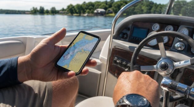
A navigation app turns your phone or tablet into a backup GPS chartplotter. If you are deciding between a dedicated unit and a phone, our guide to chartplotters vs GPS explains the differences. Look for these features:
- Charts for your area: Coverage is excellent in North America and Europe, but chart detail varies elsewhere, and many apps sell regional charts as subscriptions.
- Offline charts: Download charts before you leave, since cell coverage often drops on the water.
- Routes, waypoints, and tracks: Plan routes, mark spots, and record where you have been.
- Depth and hazard information: Shallow-area shading, community edits, and marked hazards help you avoid groundings.
- Weather and tides: Built-in data is handy, though dedicated weather apps are usually more detailed.
Safety Apps
Safety apps provide checklists, navigation rules, and float plans, and some let you request a vessel safety check or report hazards. Filing a float plan with someone on shore is one of the simplest ways to make sure help knows where to look if you are overdue.
Weather Apps
Marine weather apps focus on wind, gusts, waves, tides, and currents rather than just temperature and rain. Always compare app forecasts with official National Weather Service marine forecasts, and monitor NOAA Weather Radio on your VHF while underway.
Fishing Apps
Fishing apps add species identification, regulations, fishing spots, and catch logs. Regulations change, so confirm size and bag limits with your state fish and wildlife agency before you keep a fish.
Boat Rental Apps
Peer-to-peer rental apps connect boat owners with renters. A good platform includes ratings for both owners and renters, clear insurance terms, and the option to hire a licensed captain.
9 Must-Have Boating Apps for Boating Safety
1. iNavX
iNavX is a long-running marine navigation app for iOS and Android. Its key features include:
- Real-time position, speed, course, and waypoints
- Route planning and track recording
- GPX and KML import and export
- Weather, tide, and current information
- Optional chart packages and AIS add-ons
The base app is capable on its own, and you can add chart packs for the areas you boat. Add-on prices vary by region and provider, so check the in-app store before you buy.
2. Garmin Boating (Formerly Navionics Boating)
Navionics charts are some of the most widely used in recreational boating, and the Navionics Boating app has been folded into Garmin’s Boating app. It offers nautical charts, SonarChart high-definition bathymetry, community edits, and government charts, along with routing, tracking, distance measurement, and weather and tide data.
Chart access is sold as a subscription by region, and advanced features such as auto routing and enhanced map options are available with a paid plan. If you own a compatible Garmin chartplotter, the app can also sync routes and markers with it.
3. USCG Boating Safety App
The free U.S. Coast Guard Boating Safety app, available on iOS and Android, is the one app every U.S. boater should have. It includes:
- Federal safety equipment requirements and navigation rules
- State boating information and resources
- A float plan you can send to family or friends
- A way to request a free vessel safety check
- Hazard and pollution reporting
- An emergency assistance button that helps you contact the nearest Coast Guard unit
In an emergency, use your VHF radio on Channel 16 or call 911 first. A cell phone is a backup, not a replacement, because coverage on the water is unreliable.
4. FishWeather
FishWeather is a marine forecast app that shows wind speed and direction, waves, tides, and other conditions from a large network of weather stations and forecast models. Hour-by-hour local forecasts and some advanced data require a subscription. Even if you don’t fish, it is a quick way to check whether the wind will make your trip uncomfortable or unsafe.
5. Pro Angler
The Pro Angler app is a good companion to your navigation app. It includes a large fish species database with:
- Identification guides
- Habitat and behavior
- Gear, bait, and rigging advice
- Angling techniques and safe handling tips
- Regulation information
It also lists fishing spots, bait shops, boat launches, and charters, plus a catch log. The core app is free, with optional paid features.
6. Animated Knots
Knowing a few reliable knots is a basic boating safety skill for docking, anchoring, and securing gear. The Animated Knots app, available on iOS and Android, shows step-by-step animations for boating, fishing, and climbing knots, so you can learn the cleat hitch, bowline, and clove hitch before you need them.
7. Boatsetter
Boatsetter is a peer-to-peer boat rental platform with iOS and Android apps. You can browse boats, book with or without a captain, and owners can list their own boats to earn income when they aren’t using them. Review the insurance coverage, cancellation terms, and your state’s boater education requirements before you rent.
8. West Marine Waterlife Station
The West Marine Waterlife station on Pandora offers boating-themed music for days on the water. Pandora is mainly available in the U.S. Keep the volume low enough to hear horn signals, radio calls, and other boats.
9. Divemate
Divemate is a dive logbook app for scuba divers that lets you record dives, photos, notes, and maps. If you dive from your boat, always fly a diver-down flag or alpha flag, as required in your area, so other boaters keep their distance.
Boating Apps for Boating Safety FAQ
What is the best free boating safety app?
The U.S. Coast Guard Boating Safety app is free and covers safety equipment requirements, navigation rules, float plans, vessel safety check requests, and hazard reporting.
Can I use my phone instead of a chartplotter?
A phone or tablet makes an excellent backup, but it can overheat, lose signal, run out of battery, or get wet. Keep it in a waterproof case, carry a power bank, download charts offline, and rely on a dedicated chartplotter or paper charts as your primary navigation on larger trips.
Do boating apps work without cell service?
Most navigation apps use your phone’s GPS, which works without cell service, but only if you download charts beforehand. Weather updates, float plans, and emergency features usually need a data connection.
Should I still carry a VHF radio if I have boating apps?
Yes. A marine VHF radio is the most reliable way to call for help and receive weather alerts on the water. A VHF with DSC can send your position to the Coast Guard with one button.
How do I file a float plan?
Write down where you are going, your route, who is on board, a description of the boat, and when you expect to return, then leave it with someone reliable on shore. The USCG Boating Safety app includes a float plan you can fill out and send.
Final Thoughts
The best boating apps for boating safety are the ones you set up before you leave the dock: a navigation app with offline charts, a marine weather app, and the USCG Boating Safety app with a float plan ready to send. Add fishing, knot, and rental apps based on how you use the water.
Apps are a supplement, not a substitute, for life jackets, a VHF radio, required safety equipment, and a current boater education card. Before your next trip, make sure your boat registration is current too; see our guide on paying boat registration online. For more gear ideas, check our gifts for boaters and our tips for outfitting a sailboat.
Resources
- U.S. Coast Guard Boating Safety Division – USCG Boating Safety mobile app
- National Weather Service – marine forecasts and NOAA Weather Radio
- Garmin – Boating app and Navionics charts
- iNavX – app capabilities
- BoatUS Foundation – float plans and VHF radio use